Wright Peak-Adirondack Loj
|
| | Remnants from the 1962 B-47 crash
Says Kevin Corcoran
Just below the clouded-in summit
Says Kevin Corcoran
McIntyre Brook Waterfall along trail to Wright
Says Kevin Corcoran
Wright Peak is one of the Adirondack High Peaks, being the 16th highest of the 46 High Peaks and topping out at 4,580 feet. Wright has three qualities, which in combination, make it a very popular climb ... 1) It is a relatively short, easy hike 2) The |
|
views from the open summit are terrific 3) Along the north side of the mountain, just below the summit, one can find the remains of a B-47 bomber from the former Plattsburgh Air Force Base that crashed into the mountain in 1962, killing
| all four people on board.
The hike begins at Adirondack Loj, with the first 3. 4 miles of the hike being shared by the trail to Algonquin, the 2nd highest Adirondack mountain. The climbing is steady, but not excessively steep. The trail is badly eroded and very rocky and wet, with the hiker feeling like he/she is climbing up a gully. This trail isn't without its charms, though. At the 2. 6 mile mark, McIntyre brook comes tumbling down from the left (north) | |
|
over a very pretty, multi-stepped waterfall in excess of 100 feet.
The climbing remains steady to the 3. 4 mile mark where the trail to Wright goes left for the final 0. 4 miles. The trail straight ahead takes you 0. 9 miles
to the summit of the 5,114-foot summit of Algonquin, with Iroquois Peak lying another mile beyond.
Taking the left trail to Wright, the climbing gets steep. At about the 0. 2 mile mark after leaving the Algonquin trail, the
hiker breaks out onto open rock for the remaining, and somewhat less steep 0. 2 miles.
The views from the summit of Wright are quite spectacular, with an unimpeded 360-degree view. Neaby Algonquin Peak really catches your attention,
but there are also views of perhaps 20 other High Peaks to the northeast, east and southeast.
Make sure to make your way down the north side of Wright Peak for a 100 yards or so, just a smidgeon west of magnetic north. Here
you'll find various parts from the B-47 crash, as well as a plaque in honor of the four airmen who died. One body was never found.
Unfortunately, on my most recent hike up Wright - the only time I went up Wright with a digital
camera - there were no views due to low slung clouds and fog. Consequently, the pictures don't do this peak justice. It's not hard to find good photos of the view from Wright's summit via a quick internet search. You can also find
a few very good accountings of the B-47 crash.
The climb up Wright Peak results in an elevation gain of just under 2,400 feet. The return hike over the same route results in a total hike of 7. 6 miles. Wright Peak is a very
good ''introductory'' High Peak, with Cascade probably being the only other mountain that is more popular as a first High Peak.
Says Kevin Corcoran
Roundtrip Distance 7 miles
Elevation Gain 2,385 ft.
Says Kevin Corcoran
|
|

BIGGER SIZE PICTURE HERE

BIGGER SIZE PICTURE HERE

BIGGER SIZE PICTURE HERE
SUBMIT INPUT
| |
Map
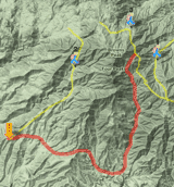
Map
Campgrounds Nearby

List of Nearby Campgrounds
Weather

Local weather forecast

|
| These outdoors activities are available near Wright Peak-Adirondack Loj. |

| | Trails Near Wright Peak-Adirondack Loj:
 Mt. Marcy-Adirondack Loj, Essex County
, 0 miles away |
|
Algonquin Peak-Adirondack Loj, Essex County
, 0 miles away |
|
Gray Peak-Adirondack Loj, Essex County
, 0 miles away |
|
Iroquois Peak-Adirondack Loj, Essex County
, 0 miles away |
|
Mt. Colden-Adirondack Loj, Essex County
, 0 miles away |
|
| | Campgrounds Near Wright Peak-Adirondack Loj:
 Whispering Pines Campground, Lake Placid
, 4 miles away |
|
Adirondak Loj, Lake Placid
, 5 miles away |
|
Meadowbrook, Ray Brook
, 10 miles away |
|
Pioneer Village, Ray Brook
, 10 miles away |
|
Wilmington Notch Camp Ground, Upper Jay
, 11 miles away |
|
| | Whitewater Near Wright Peak-Adirondack Loj:
 Ausable River - West Branch, Essex
County
, 1 miles away, Class III - 6.5 miles long (Adirondak Loj Road to Route 73) |
|
John's Brook, Essex
County
, 5 miles away, Class V - 4 miles long (Caretaker's Cabin to Moutaineer Outfitters in Keene Valley) |
|
Ausable River - West Branch, Essex
County
, 7 miles away, Class III-IV+ - 3.5 miles long (Monument on Route 86 to High Falls) |
|
Ausable River - West Branch, Essex
County
, 10 miles away, Class V+ - 0.25 miles long (High Falls Gorge) |
|
Cold River, Franklin/ Essex/ Hamilton
County
, 10 miles away, Class II-V+ - 14 miles long (Duck Hole to mouth) |
|
| | Hotels Near Wright Peak-Adirondack Loj:
 Econo Lodge Lake Placid, Lake Placid
, 4 miles away |
|
Rodeway Inn Lake Placid, Lake Placid
, 4 miles away |
|
Courtyard Lake Placid, Lake Placid
, 4 miles away |
|
Prague Inn Suites And Cottages, Lake Placid
, 5 miles away |
|
Spruce Lodge Bed & Breakfast & Guest Cottage, Lake Placid
, 5 miles away |
|
| | Lakes Near Wright Peak-Adirondack Loj
 Lake Placid, Essex County
, 6 miles away |
|
Copperas Pond, Essex County
, 9 miles away |
|
Franklin Falls Pond, Franklin County
, 13 miles away |
|
Pine Pond, Franklin County
, 13 miles away |
|
|
|
 |
|


 US Hiking Trails > New York > Wright Peak-Adirondack Loj


